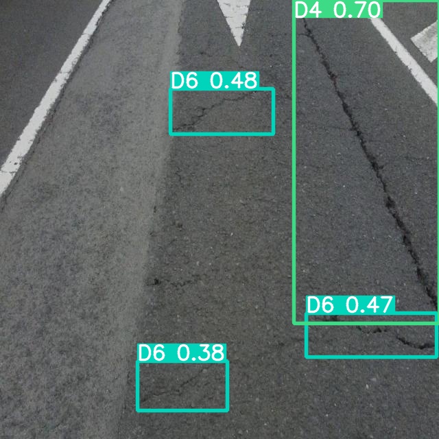
Computer vision system based on Deep Learning capable of detecting, localizing and categorizing 13 different types of superficial road defects, from 2D photos.
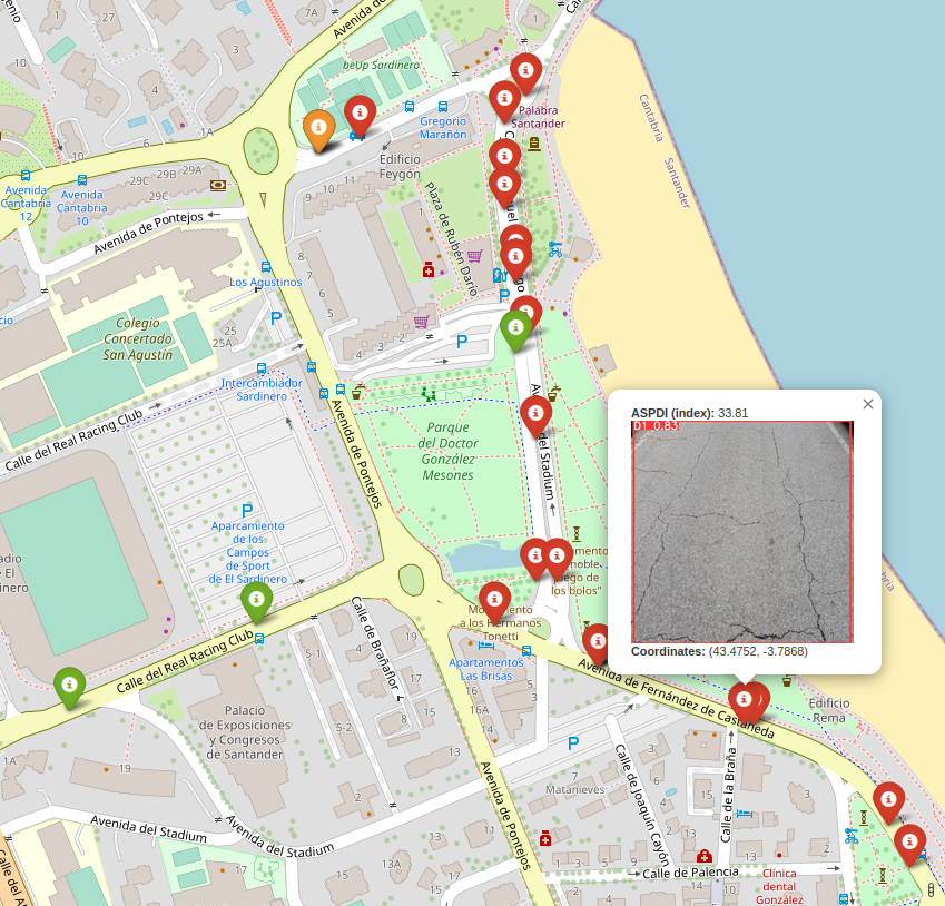
MAPSIA
The MAPSIA System is the name for the image gathering device. Any vehicle can use the Mosquito system, which delivers high-quality georeferenced photos at normal driving speeds.
DEEP LEARNING BASED SOLUTION
Our algorithm locates, detects and classifies up to 13 types of road defects. With the model outputs, a pavement condition index has been engineered.